Cairns And Port Douglas To The Daintree: Driving, The Ferry And Tours
The sealed road up from Cairns is easy the whole way to the rainforest, until it reaches a river with no bridge. Here is how the drive works from both bases, what the cable ferry does, and where a guided day beats your own hire car.
The sealed road up from Cairns stays smooth and coastal almost the whole way to the rainforest. It runs easy past Port Douglas and Mossman, then reaches a river with no bridge across it. To carry on to Cape Tribulation you drive onto a cable ferry, cross the Daintree River, and pick up a narrower, more winding road on the far side. That single crossing is the hinge of the trip north, and it is the part first-time visitors ask about most.
Booking Choice: For a one-day visit from Cairns or Port Douglas, 3063CTDT includes return transport, the ferry, a Daintree River cruise, guided rainforest and beach walks, lunch and park fees.
Check Dates For The Daintree And Cape Tribulation Day TourThis guide lays out the drive from both common bases, how the ferry works and what it costs to use, what changes once you are on the northern side, and where a guided day makes more sense than your own hire car. The full-day trips run by Daintree Rainforest Tours handle the ferry, the timing and the park fees for you, though plenty of people still enjoy doing the drive themselves.
At a glance: driving time north from Cairns
Approximate driving times. The route is sealed to Cape Tribulation, but it narrows and winds north of the ferry. The crossing, stops, traffic and current conditions add time.
How Do You Get From Cairns To The Daintree?
The drive from Cairns to the Daintree River ferry takes about 1.5 to 2 hours up the sealed Captain Cook Highway. Mossman Gorge sits roughly 1.5 hours north, and Cape Tribulation is another hour of narrower road past the ferry, so plan on about 2.5 to 3 hours all up. Check current road conditions and your hire agreement before travel.
The first stretch out of Cairns is the pretty one. The Captain Cook Highway hugs the coast, climbs over a couple of headlands with ocean lookouts, and drops back down to cane fields before Port Douglas. Traffic is light once you clear the northern beaches, and the surface stays good the whole way to the river. You are on a sealed two-lane road rather than a track, but you should still confirm current conditions and the permitted roads in your hire agreement.
Past Mossman the highway turns inland briefly, then the Daintree Village turnoff appears. Keep straight for the ferry rather than following signs into the village itself, which sits upriver and is a separate detour. The Wet Tropics of Queensland, the rainforest you are heading into, is a UNESCO World Heritage area, and the landscape starts to close in with forest on both sides as you near the crossing.
Timing the start makes a bigger difference than the exact route. Leave Cairns by around seven or eight in the morning and you arrive at the ferry before the coach tours and the worst of the heat, with the animals still active and the light still soft. Leave at ten and you inherit the queue, the crowds at Mossman Gorge and a hotter, slower forest. There is no toll and no fast lane on this road, so an early alarm is the single best thing you can do for the day.
| From Cairns to | Approx driving time | Approx distance | Road |
|---|---|---|---|
| Port Douglas turnoff | 1 hour | ~67 km | Sealed highway |
| Mossman Gorge | 1.5 hours | ~75 km | Sealed |
| Daintree River ferry | 1.5 to 2 hours | ~85 km | Sealed |
| Cape Tribulation | 2.5 to 3 hours | ~135 km | Sealed, narrow and winding past the ferry |
How Far Is The Daintree From Port Douglas?
Port Douglas sits about an hour north of Cairns, roughly 67 km up the coast, which makes it the closer base. From Port Douglas, Mossman Gorge is about 20 minutes, the Daintree River ferry around 40 to 50 minutes, and Cape Tribulation about 1.5 to 2 hours. A Port Douglas start saves close to 45 minutes each way.
That saving matters more than it sounds. On a day trip you spend the difference twice, once going and once coming back, so basing in Port Douglas can hand you an extra hour and a half in the forest instead of on the highway. It is why the region's overnight visitors so often choose the smaller town, and why the small-group departures leave from there. If you are weighing the two towns as a base, our guide on choosing between a Cairns or Port Douglas base goes deeper on who each suits.
| From Port Douglas to | Approx driving time | Notes |
|---|---|---|
| Mossman Gorge | 20 to 25 min | Short hop up the highway, then the gorge road |
| Daintree River ferry | 40 to 50 min | Sealed the whole way |
| Cape Tribulation | 1.5 to 2 hours | Includes the ferry and the winding northern road |
How Does The Daintree River Cable Ferry Work?
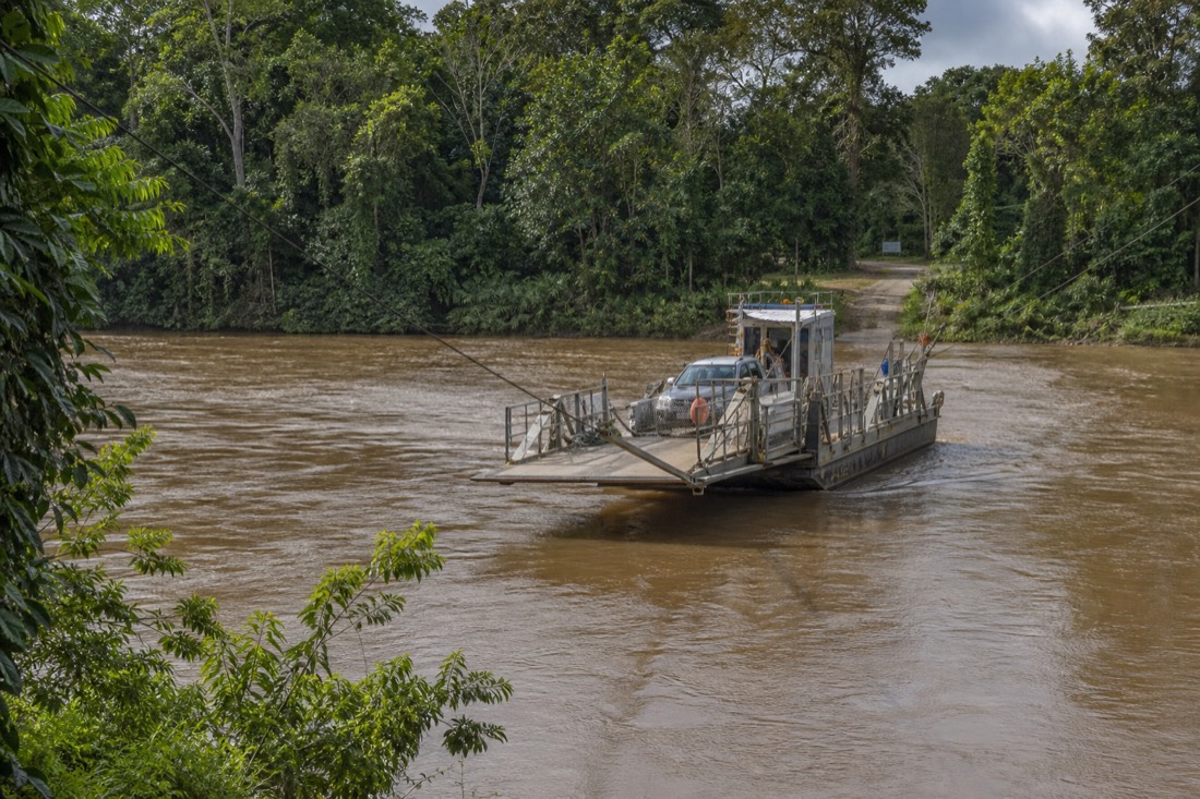
The Daintree has no road bridge, so a cable ferry carries vehicles and foot passengers across the river. A flat, open deck runs along a fixed cable, takes a handful of cars at a time, and shuttles back and forth continuously through the day. You queue on the bank, drive on when the attendant waves you forward, and pay at the crossing.
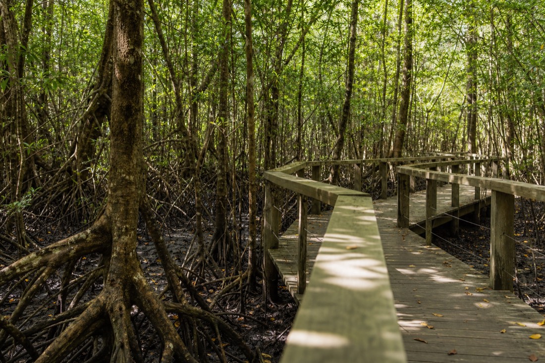
The crossing itself is short, a couple of minutes of sliding across brown tidal water with mangroves on either side. There is no booking and no timetable to catch, because the ferry simply runs on repeat while it is operating. Foot passengers and cyclists can ride too, at a lower rate than a vehicle. On peak weekends and school holidays a queue can build on the southern bank, so an early start pays off if you want to be across before the coach traffic.
There is a reason the river was never bridged. It is wide, tidal and prone to flooding, it holds estuarine crocodiles, and keeping the northern side hard to reach has been part of protecting the forest there. The ferry is the compromise: enough access for visitors and residents, not so much that Cape Tribulation turns into a through-route. Understanding that helps the whole northern side make sense, from the narrow roads to the lack of services.
You stay in your car for the crossing. It is a working ferry, not an attraction, and the whole thing is over before you have finished reading the safety sign. What it buys you is access to the northern side of the river, the Cape Tribulation section where the rainforest runs down to the sea.
What Does The Ferry Cost And When Does It Run?
The ferry charges a small fee set and published by Douglas Shire Council, paid at the crossing rather than booked ahead. A return vehicle fare is the usual ticket, with a lower one-way price and a separate, cheaper rate for pedestrians and cyclists. Fares change over time, so check the current Douglas Shire Council amount before you go instead of trusting an old figure.
From 1 July 2026, a standard car costs A$35 one way or A$57 return on the ferry. Online QR tickets are available; the operator recommends buying at least 24 hours ahead. Confirm service notices before driving.
We deliberately do not quote a dollar figure here, because the council reviews the rate and any number printed on a travel page ages quickly. The fee is modest in the scheme of a day out, and it is the same whether you are a nervous first-timer or a local. Check the council's current payment methods and ticket options before travel, including whether a return or one-way ticket fits your route. For the full picture, including how the return-versus-one-way choice works, see our note on what the ferry costs and how to check it.
Operating hours and interruptions can change, so confirm the current first and last crossings, planned closures and service notices before setting the day's schedule. The one time it bites is a late return from Cape Tribulation: if you dawdle over sunset and dinner, confirm the last-crossing time first, because being stranded on the northern bank overnight is a genuinely bad end to the day. A guided tour sidesteps all of this, since the operator times the crossings and the fee is already in your fare.
| Ticket | How it is charged | Where you pay |
|---|---|---|
| Vehicle, return | Per vehicle, both crossings on one ticket | At the crossing |
| Vehicle, one way | Per vehicle, single crossing | At the crossing |
| Pedestrian or cyclist | Lower per-person rate | At the crossing |
What Changes On The Road North Of The Ferry?
North of the ferry the drive changes character. The road is still sealed as far as Cape Tribulation, but it climbs the Alexandra Range, narrows, and turns tight and winding in sections that ask for real attention. Beyond Cape Tribulation the pavement ends and the Bloomfield Track begins, which is four-wheel-drive only.
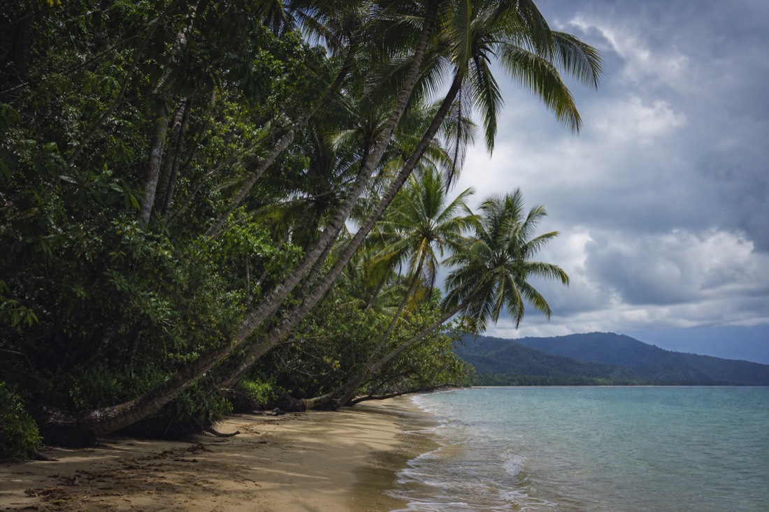
The first few kilometres after the crossing climb steeply to the Alexandra Range lookout, a panoramic stop over the river mouth and the coastline. From there the road threads through dense forest with blind corners, one-lane bridges over creeks, and the occasional steep dip. The sealed route is generally used by standard vehicles, but drivers should check current road conditions and their hire agreement. It is slow, and average speed can be well below what the map distance suggests.
Wildlife is the real reason to ease off. Cassowaries cross this road, especially early and late in the day, and a large flightless bird stepping out of the verge is not something you can brake for at speed. Follow posted speed limits, slow down for conditions and watch the shoulders; this gives you more time to respond if wildlife enters the road.
Rain reshapes the drive too. Even in the dry season a short tropical downpour can slick the surface and drop leaf litter across the bitumen, and in the wet season creek levels rise fast. Check current road notices before departure. The Wet Tropics Management Authority provides wider World Heritage information. If heavy rain is forecast, allow more time and be ready to change your route.
Do You Need A 4WD For The Daintree?
You generally do not need a four-wheel-drive for the sealed route through Mossman, across the ferry and to Cape Tribulation. Check current road conditions and your hire agreement before travel. A four-wheel-drive may be required for unsealed routes beyond Cape Tribulation and for specific off-road terrain.
A guided tour is not evidence that a 4WD is needed for the sealed road to Cape Tribulation. Check current road conditions and the specific hire agreement before choosing a vehicle.
This trips up a lot of visitors who assume a rainforest means mud and low range. For the crossing, the boardwalks, Mossman Gorge, the beaches and the ice cream stop, a two-wheel-drive is generally suitable when current road conditions and the hire agreement allow. Where a proper 4WD earns its keep is off the sealed network: the creek-crossing tracks and steep private property that only a purpose-built vehicle and an experienced driver should attempt. Our rundown of the region's unsealed tracks beyond the pavement covers where that line falls.
| Route | Surface | Vehicle |
|---|---|---|
| Cairns to Mossman to the ferry | Sealed | Standard vehicle when conditions and hire terms permit |
| Ferry to Cape Tribulation | Sealed, narrow and winding | Check current conditions and hire terms; drive to conditions |
| Bloomfield Track (north of Cape Trib) | Unsealed, creek crossings | 4WD only, guided recommended |
| Private off-road property tours | Rough track | Operator's 4WD or UTV only |
Where Does The Bloomfield Track Go?
The Bloomfield Track is the unsealed four-wheel-drive road that continues north of Cape Tribulation toward Cooper Creek, Bloomfield and, eventually, Cooktown. It forms part of the coastal route north toward Bloomfield and Cooktown, and current road and creek conditions should be checked before travel. Most hire-car agreements specifically exclude it.
The route beyond Cape Tribulation needs more preparation than the sealed approach road. Steep sections, changing conditions and limited phone coverage require careful planning. Many hire agreements exclude the Bloomfield Track or unsealed roads. Compare the off-road tour formats if you prefer an operator-led trip: the three-day Cooktown and Daintree tour includes Wujal Wujal to Cape Tribulation, while shorter sightseeing tours follow different routes.
Road conditions, closures and vehicle requirements must be checked for the actual travel date. A guided booking does not guarantee that a track will open, and a seasonal calendar does not establish whether a crossing is passable. Never enter floodwater.
Should You Self-drive Or Take A Guided Day Tour?
Self-driving gives you your own pace and the freedom to linger, which suits a relaxed two or three day trip staying up in the forest. A guided day trades that freedom for someone else handling the ferry, the timing, the park fees and the wildlife spotting, and it turns a long solo drive into a day you can actually watch out the window.
The honest split is about what you value on the day. Driving yourself means you stop where you like and stay as long as you want, but you also do three hours behind the wheel each way from Cairns, much of it on that winding northern road, and you spot wildlife on your own. A guide reads the forest for you, points out a Boyd's forest dragon you would have driven straight past, and frames the crocodile-safety rules and the Kuku Yalanji cultural context that a self-drive day leaves out. For a first visit especially, the interpretation is what most people remember. If you want to see exactly what is doable alone, read whether you can visit the Daintree on your own. Tourism Australia's own Tourism Australia guide to the Daintree is a useful sanity check on distances and conditions before you commit.
| Factor | Self-drive | Guided day tour |
|---|---|---|
| Pace and stops | Entirely yours | Set schedule |
| The drive | Up to 3 hours each way from Cairns | You ride and watch |
| Ferry and fees | You queue and pay | Included on the listed tours; the operator manages the crossing schedule |
| Wildlife spotting | On your own | Trained guide's eyes |
| Cultural and natural context | What you read yourself | Explained as you go |
| Best for | Multi-day forest stays | First visits and single days |
Where Do You Park At Mossman Gorge And Cape Tribulation?
Check the current Mossman Gorge Centre parking and shuttle arrangements before travel. At Cape Tribulation, confirm current access and parking conditions for the main beach and boardwalk stops. Swimming at Mossman Gorge is not recommended because currents and submerged hazards can be unpredictable.
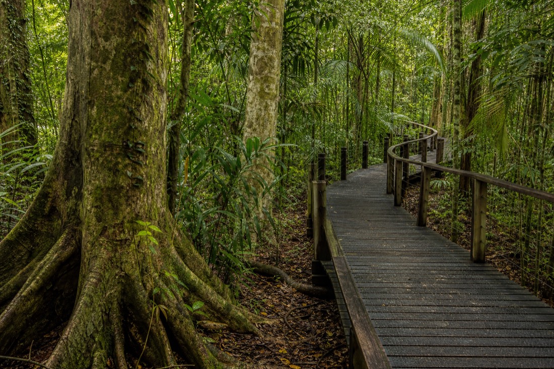
The Mossman Gorge Centre is the official gateway, run as the community's own visitor operation, with parking, changing facilities and a cafe. Shuttle access, times, fares and private-vehicle rules are set by the Mossman Gorge Centre, so confirm the current arrangements before travel rather than expecting to drive straight in. Arriving before the Cairns coaches, ideally soon after opening, gives you a quieter walk and better canopy light. The boardwalk at Mossman Gorge is short and easy, and it rewards more time than most day-trippers give it.
Up at Cape Tribulation the parking is simpler and free, small gravel or dirt bays at each walk and beach access. There is no barrier and no ticket, but there is also not much of it, so a mid-morning arrival on a dry-season Saturday can mean waiting for a space. Early is better here too.
Where Should You Fill Up On Fuel?
Plan to fill up before crossing the river, then check current fuel locations, opening hours and payment availability north of the ferry. Top up in Mossman or Port Douglas, carry water and food, and confirm that your vehicle has sufficient range for the planned route.
Plan fuel around your vehicle’s range and confirm opening hours before setting off. QPWS lists fuel at Rainforest Village north of the ferry; carry the supplies needed for any longer route.
Services and phone coverage can be limited north of the river. Check current fuel and grocery availability before crossing rather than relying on older descriptions of the number of outlets. Fuel range varies by vehicle and conditions, so start with a full tank and use your vehicle's range estimate for the return trip. Carry sufficient food and water for your party and planned travel time. The best months to make this drive fall in the dry season, and our guide to the best months to make the drive lays out how the weather shifts the whole trip.
| Stop | Fuel | Supplies |
|---|---|---|
| Cairns | Plentiful | Full range |
| Port Douglas | Yes | Supermarket, cafes |
| Mossman | Yes, last easy fill | Supermarket, bakery |
| North of the ferry | Limited, expensive | Minimal, carry your own |
What Does A Daintree Day Actually Look Like From Each Base?
A self-drive day from Cairns runs long: two hours up, the ferry, a boardwalk or two near Cape Tribulation, the ice cream stop, then the same drive back, often after dark. From Port Douglas the same day is far gentler, with an extra hour or more to spend in the forest instead of on the highway.
Laid side by side, the two days feel different. From Cairns you are committed to a big drive at both ends and you watch the clock all afternoon to make the ferry and beat the dark on that winding road. From Port Douglas you can have a slow breakfast, be at Mossman Gorge before the crowds, cross the river by late morning, and still get home for dinner without rushing. Either way, a guided full-day Cape Tribulation tour or the small-group tour from Port Douglas removes the driving entirely, so you spend the whole day looking rather than steering. Add what to do at Cape Tribulation and, if you want the river up close, a wildlife cruise on the river, and the shape of the day fills in.
| Time | Self-drive from Cairns | Self-drive from Port Douglas |
|---|---|---|
| Morning | 2 hour drive north | Slow start, short hop to Mossman |
| Midday | Ferry, then Mossman or push to Cape Trib | Ferry crossed early, forest time |
| Afternoon | Boardwalks and beach, watch the clock | Boardwalks, beach, unhurried |
| Evening | 2 hour drive back, part in the dark | Home for dinner without rushing |
Whichever way you tackle it, the crossing is the moment the trip tips from a coastal drive into a rainforest one. Get to the ferry early, keep your speed sensible on the far side, and give Mossman Gorge and Cape Tribulation more time than the map makes you think they need.